Madeira
Geography
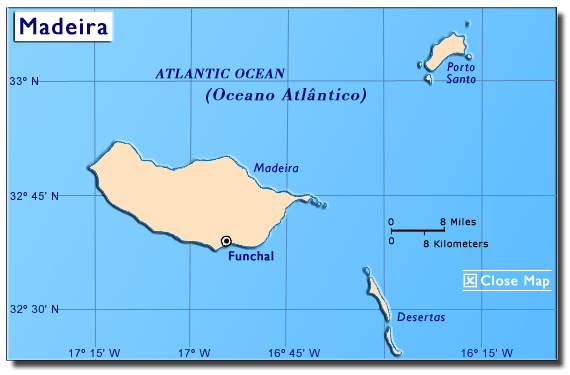
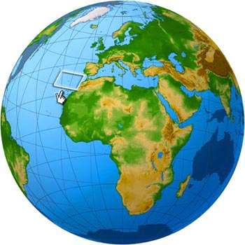 The Madeira archipelago
is located about 360 miles west of Morocco (in northwest Africa)
in the Atlantic Ocean (Madeira Islands, 2004). It is about
535 miles from Lisbon. The archipelago is comprised of Madeira
and Porto Santo, as well as the Desertas and the Selvagens
island groups, which are deserted. The total land area is
308 square miles with an estimated population
of 255,403 people (UK Trade & Investment, 2005).
The Madeira archipelago
is located about 360 miles west of Morocco (in northwest Africa)
in the Atlantic Ocean (Madeira Islands, 2004). It is about
535 miles from Lisbon. The archipelago is comprised of Madeira
and Porto Santo, as well as the Desertas and the Selvagens
island groups, which are deserted. The total land area is
308 square miles with an estimated population
of 255,403 people (UK Trade & Investment, 2005).
Madeira, the largest island, is home to Funchal, the capital
city (UK Trade & Investment, 2005). Madeira is also known
as Pérola do Atlântico (Atlantic Pearl). Before his
famous trip to the New World, Christopher Columbus lived on
Porto Santo where he started a family. He was married to
Felipa Moniz Perestelo, the daughter of Porto Santos Governor,
Bartolomeu Perestrelo, a sea explorer and one of the discoverers
of Madeira. The Columbus estate has become the Christopher
Columbus Museum of Porto Santo (Maderia-island.com, n.d.).
Climate
Madeira has a tropical climate
mainly characterized by its very mild summers and winters.
Temperatures range from 22° C (76° F) in the summer to 16°
C (61° F) in the winter (Madeira, n.d.).
History
In 1418, João Gonçalves, Tristão Zarco and Vaz Teixeira discovered
the uninhabited island of Porto
Santo accidentally while exploring the coast of West Africa
for Prince Henry the Navigator (Madeira-web, n.d.a). The story
goes that a storm blew them into the port, and hence, they
named it the Holy Port or Porto Santo. Prince Henry immediately
sent Bartolomeu Perestrelo, a very
knowledgeable cartographer and navigator, to settle the
island. Christopher
Columbus married Perestrelos daughter and lived in Porto
Santo for a short while (Madeira-island, n.d.).
Within a year, Zarco and Teixeira discovered another uninhabited
island, which they named Madeira. Prince
Henry set forth to settle this island with people from the
Algarve region of Portugal (Madeira-web, n.d.b). This island,
along with Porto Santo and the uninhabited Desertas
and Selvagens (clusters of tiny islands), became known
as the Madeira archipelago (Madeira-web, n.d.c). These
discoveries became the first of many as the Portuguese went
on to reach the East Indies.
On the island of Porto
Santo, grape and grain farming became important as well
as cattle breeding (Madeira-web, n.d.a). Madeira
became known for grain and sugar cultivation. Later, the islands
became a tourist destination and remain so today (Guia Madeira,
n.d.).
Political Organization
 In
1976, Madeira
became an Autonomous Region of Portugal with a government
lead by an elected President and a legislative branch known
as a Regional Assembly (Madeira Islands, 2004). The respective
Presidents and the members of the Regional Assemblies are
elected by popular vote. The Portuguese government appoints
a Minister of the Republic to represent the central government
in the Autonomous Regions (Symington, 2000). In
1976, Madeira
became an Autonomous Region of Portugal with a government
lead by an elected President and a legislative branch known
as a Regional Assembly (Madeira Islands, 2004). The respective
Presidents and the members of the Regional Assemblies are
elected by popular vote. The Portuguese government appoints
a Minister of the Republic to represent the central government
in the Autonomous Regions (Symington, 2000).
Economy
Madeira,
also an important tourism destination, produces wine, flowers
and embroideries for export (Madeira, n.d.).
|